| dc.contributor.advisor | Ahern, Judson L. | |
| dc.contributor.author | Cates, Steven William | |
| dc.date.accessioned | 2017-08-28T16:21:22Z | |
| dc.date.available | 2017-08-28T16:21:22Z | |
| dc.date.issued | 1989 | |
| dc.identifier.uri | https://hdl.handle.net/11244/51939 | |
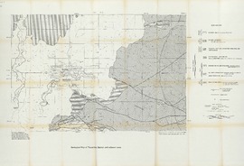
| dc.description.abstract | Declining water flow from springs in the Travertine District, Chickasaw National Recreation Area (CNRA) spurred geologic investigation of the area. Because geologic structure may influence hydrology, knowledge of structure was needed to understand the problem of declining spring flow. Pennsylvanian-aged conglomerate covers CNRA, obscuring the geology beneath the park that controls the hydrology. To further understand the geologic structure below and contiguous to CNRA, a geological and geophysical investigation was carried out. Ordovician outcrop is found east of CNRA and at a few isolated locations where it has been exposed by erosion of Pennsylvanian rock. Subsurface data from oil wells is available for the area west of CNRA. In those areas where Pre-Pennsylvanian rocks can be seen, surface geological reconnaissance was done. Maps and cross-sections were constructed from subsurface and outcrop data to define structural trends. | |
| dc.description.abstract | Gravity and magnetic data were acquired for the area surrounding and including CNRA between the outcrop data and the subsurface data. Analysis of gravity and magnetic data, obtained from 180 data stations in a 125 square kilometer area surrounding, and including, CNRA, is presented. These data are analyzed using a Fast Fourier Transform computer program. Second vertical derivatives are computed and incremental downward continuation of the gravity and magnetic fields is carried out. Utilizing geologic data from various sources, density model inversion of gravity data was done using a least-squares matrix inversion computer program. North-south observed gravity profiles were used to develop geologically feasible models of the structural geometry for areas of limited geologic data. | |
| dc.description.abstract | Interpretation and synthesis of these data sets resulted in the interpolation of fault locations beneath the Pennsylvanian-aged conglomerate. | |
| dc.format | xiv, 106 leaves : ill., maps ; 29 cm.. | |
| dc.language | en_US | |
| dc.subject | Faults (Geology) -- Oklahoma -- Sulphur | |
| dc.subject | Geology, Structural -- Oklahoma -- Sulphur | |
| dc.subject | Petroleum -- Geology -- Oklahoma -- Sulphur | |
| dc.title | Fault distribution in the Sulphur, Oklahoma area based on gravity, magnetic and structural data | |
| dc.type | Thesis | |
| dc.type | text | |
| dc.contributor.committeeMember | Stearns, David W. | |
| dc.contributor.committeeMember | Harper, Charles W., Jr. | |
| dc.date.manuscript | 1989 | |
| dc.thesis.degree | Masters of Science | |
| dc.note | Includes bibliographical references (leaves 98-101) | |
| ou.group | College of Geosciences::School of Geology and Geophysics | |