Search
Now showing items 28161-28170 of 46451
Right of Way for Railroad Purposes
(1883-01-09)
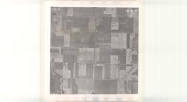
Aerial Photo of Garfield County, OK, USA, OE-3N-149
(United States Government, 1954-07-30)
Oklahoma aerial photographs in this collection are public domain and were created by U.S. government agencies or contractors to those agencies. The photos are marked with a flight and frame number at the top of the photos, ...
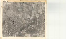
Aerial Photo of Hughes County, OK, USA, AWH-3-41
(United States Government, 1938-04-10)
Oklahoma aerial photographs in this collection are public domain and were created by U.S. government agencies or contractors to those agencies. The photos are marked with a flight and frame number at the top of the photos, ...
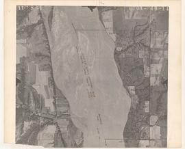
Aerial Photo of Blaine County, OK, USA, 0A-4B-14
(United States Government, 1941-11-08)
Oklahoma aerial photographs in this collection are public domain and were created by U.S. government agencies or contractors to those agencies. The photos are marked with a flight and frame number at the top of the photos, ...


High and dry: institutional impediments to effective drought management and relief in the 1995-96 and 1998 Oklahoma droughts
(2001)
This thesis examines the abilities of government entities and non-governmental organizations (NGOs) in Oklahoma to work in concert using institutional and organizational learning precepts to effectively plan for and mitigate ...
F-Harmonic Maps in Kahler Geometry
(2017-05-12)
Let u be an F-harmonic map between Kahler manifolds of finite dimensions. When is u holomorphic or anti-holomorphic? In the special case of a harmonic map, Y. T. Siu gave an affirmative answer when the target manifold is ...
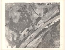
Aerial Photo of Pawnee County, OK, USA, BQK-4-70
(United States Government, 1938-07-13)
Oklahoma aerial photographs in this collection are public domain and were created by U.S. government agencies or contractors to those agencies. The photos are marked with a flight and frame number at the top of the photos, ...