| dc.contributor.advisor | Stewart, Gary F. | |
| dc.contributor.author | Hopper, James Frank | |
| dc.date.accessioned | 2014-03-14T21:51:27Z | |
| dc.date.available | 2014-03-14T21:51:27Z | |
| dc.date.issued | 2005-05-01 | |
| dc.identifier.uri | https://hdl.handle.net/11244/8024 | |
| dc.description.abstract | The purpose of this study was to see if trends of "Cherokee" sandstones within the study area could be mapped effectively, for petroleum exploration, if (a) sandstones are defined relative to the spontaneous potential curve only, if (b) sandstones are mapped by aggregate thickness, and if (c) sandstones are mapped by geologic software such as Geographix by Landmark Graphics Corportation. Data was used from scout cards, state completion reports, small scale electric logs and electronic data provided by IHS Energy. Thirteen stratigraphic cross-sections and thirteen structural cross-sections were constructed in grid pattern across the study area. Structural contour maps were and isopach maps of aggregate sand thickness were constructed for the "Cherokee" sandstones. Maps of the "Cherokee" sandstones could be mapped effectively for petroleum exploration using the three criteria set forth. These maps are efficient as a first-approximation for the distribution and configuration of the reservoirs. The Geographix software is adequate for providing useful documents quickly and easily. It can contour structure maps adequately but lacks the "human intuition" to contour the sandstone isopach maps reasonably. | |
| dc.format | application/pdf | |
| dc.language | en_US | |
| dc.publisher | Oklahoma State University | |
| dc.rights | Copyright is held by the author who has granted the Oklahoma State University Library the non-exclusive right to share this material in its institutional repository. Contact Digital Library Services at lib-dls@okstate.edu or 405-744-9161 for the permission policy on the use, reproduction or distribution of this material. | |
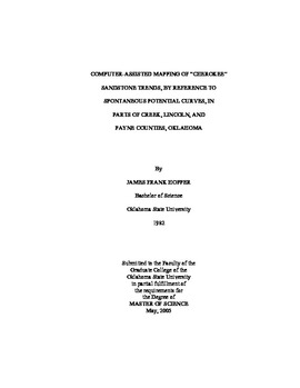
| dc.title | Computer-assisted Mapping of "Cherokee" Sandstone Trends, by Reference to Spontaneous Potential Curves, in Parts of Creek, Lincoln, and Payne Counties, Oklahoma | |
| dc.type | text | |
| dc.contributor.committeeMember | Cemen, Ibrahim | |
| dc.contributor.committeeMember | Puckette, James O. | |
| osu.filename | Hopper_okstate_0664M_1366.pdf | |
| osu.college | Arts and Sciences | |
| osu.accesstype | Open Access | |
| dc.description.department | Boone Pickens School of Geology | |
| dc.type.genre | Thesis | |
