| dc.contributor.advisor | Puckette, James O. | |
| dc.contributor.author | Bacon, Michael Cody | |
| dc.date.accessioned | 2014-03-14T21:51:07Z | |
| dc.date.available | 2014-03-14T21:51:07Z | |
| dc.date.issued | 2012-12-01 | |
| dc.identifier.uri | https://hdl.handle.net/11244/7995 | |
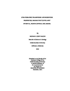
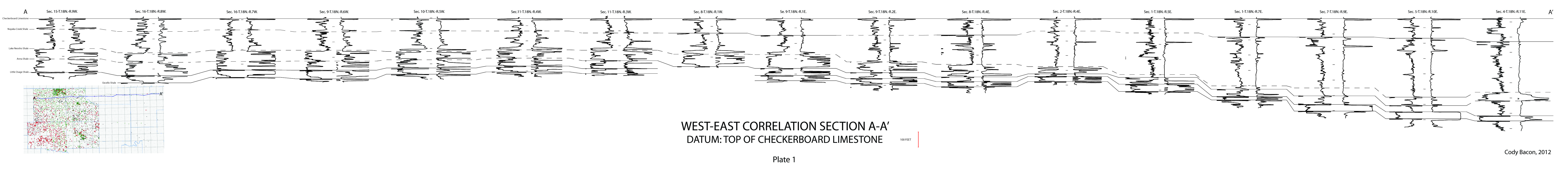
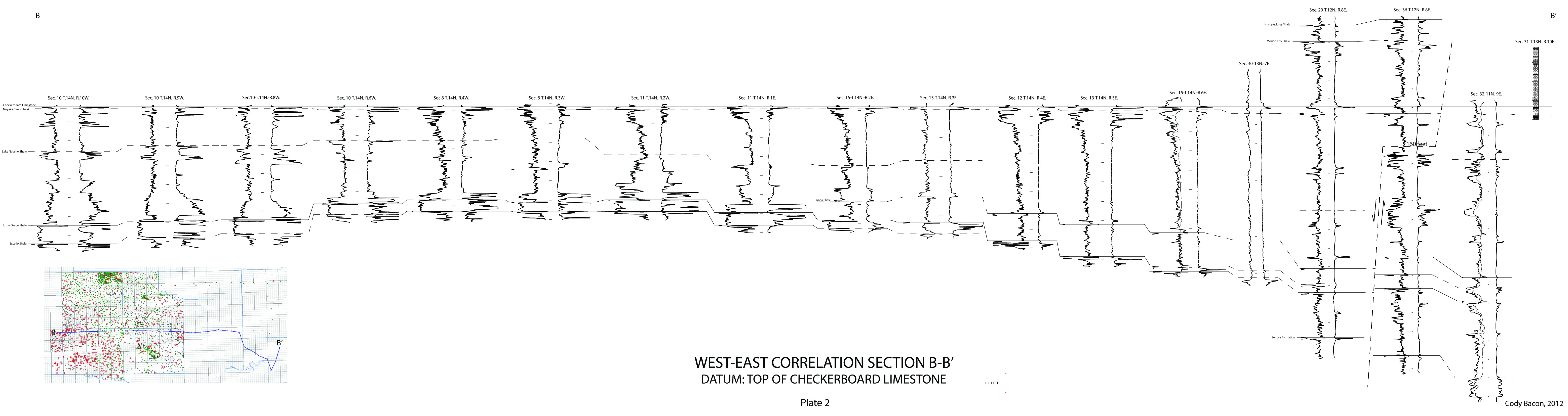
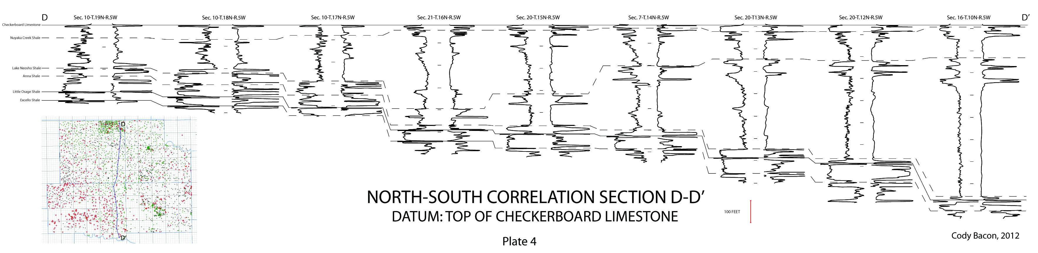
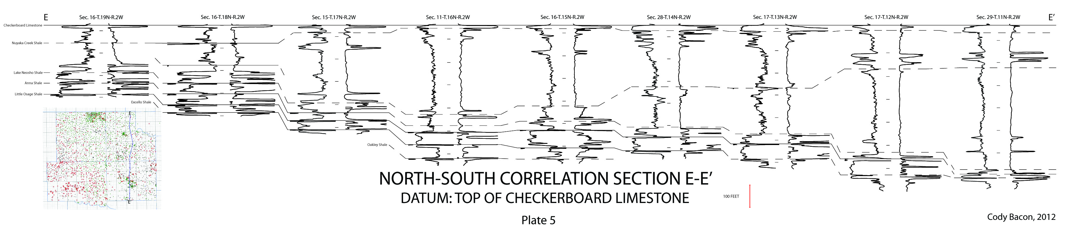
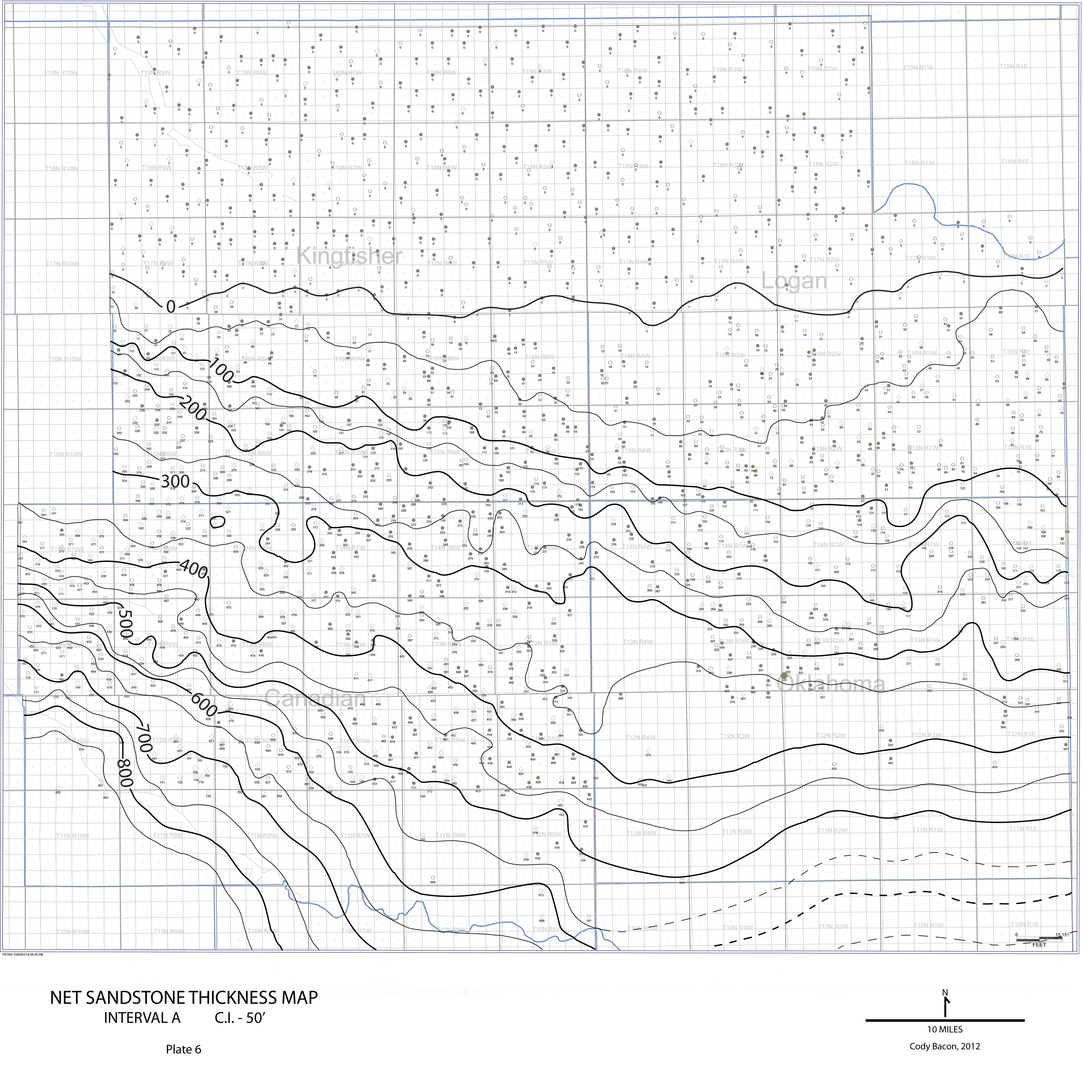
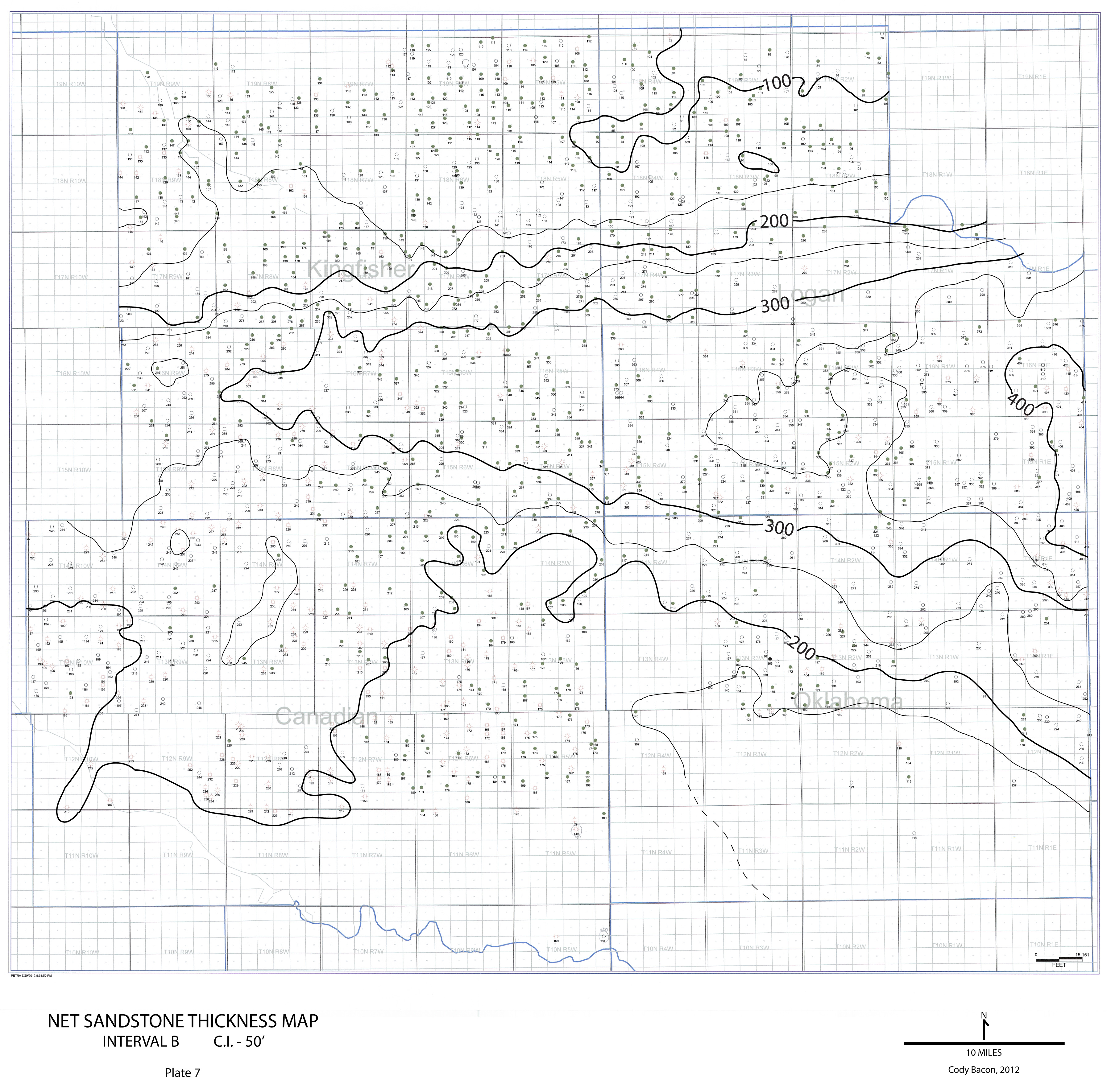
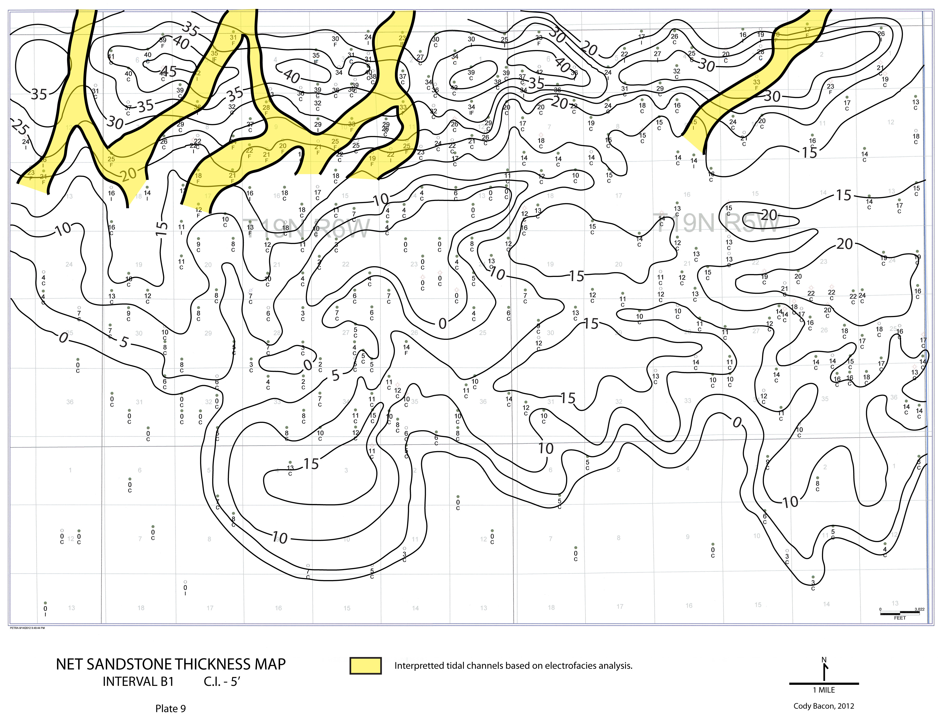
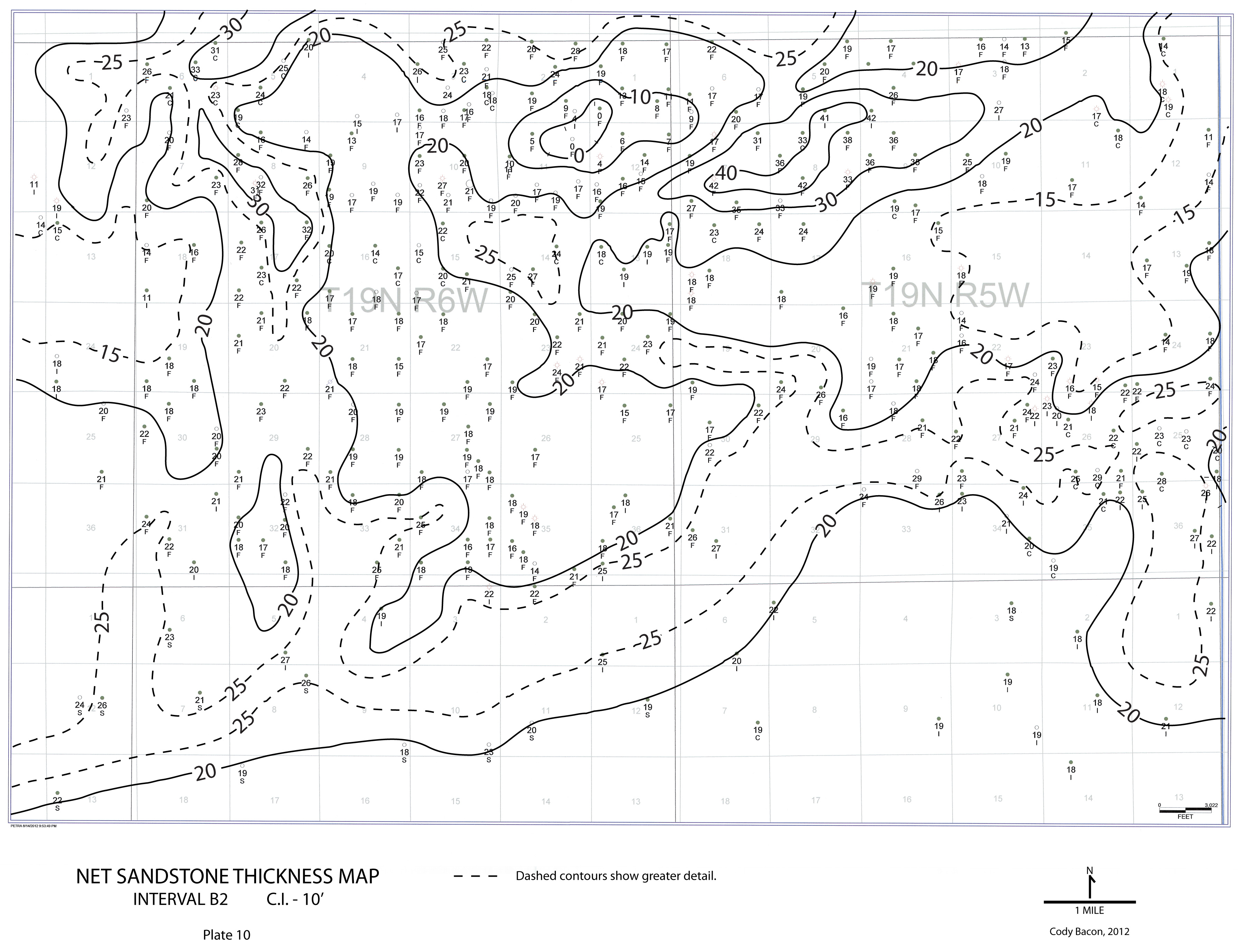
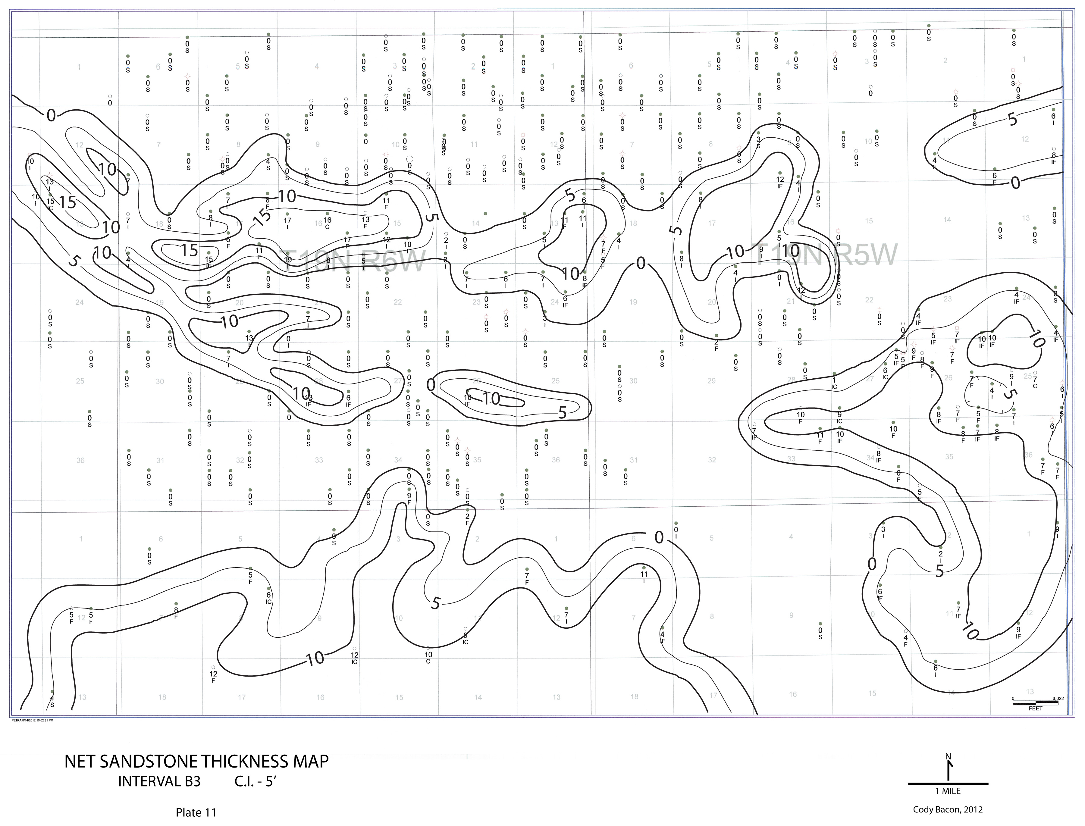
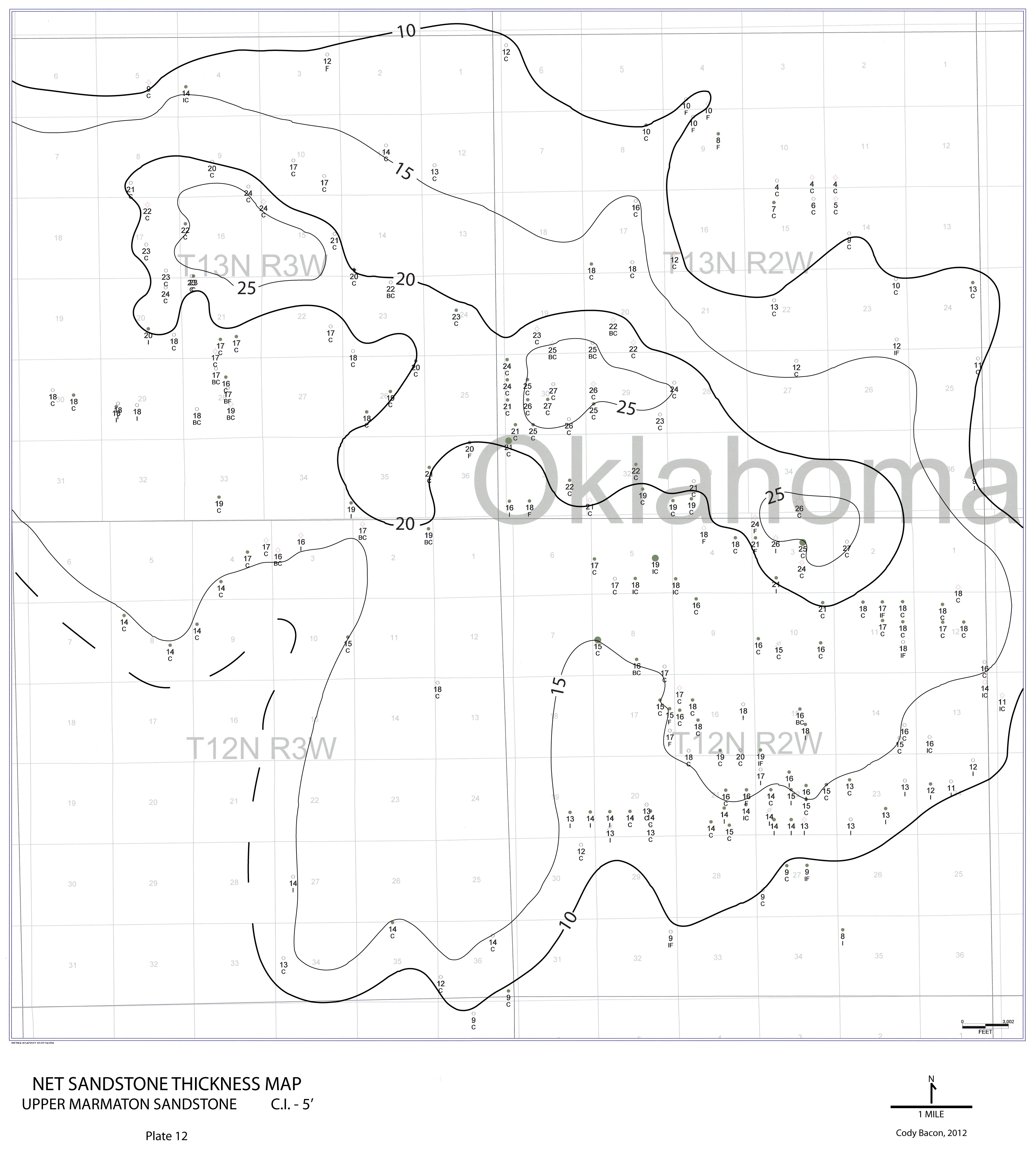
| dc.description.abstract | The Marmaton/"Cleveland" interval in north-central Oklahoma contains multiple mappable sandstone bodies that are often labeled "Cleveland", because they occur below the Checkerboard Limestone and above the Marmaton carbonate. Maximum Flooding Surfaces (MFSs) are chronostratigraphic markers with distinct radioactive signatures on gamma-ray logs and are essential to defining a stratigraphic framework. However, these markers are not always evident on wireline logs and without log responses, it is very difficult to determine their stratigraphic position. In an attempt to clear up confusing nomenclature, subsurface data consisting of (>3400) wireline logs were correlated to outcrops in Tulsa and Okfuskee Counties where the formal surface stratigraphy is established. These correlations of MFSs were essential for defining a stratigraphic framework and subdividing the Marmaton/"Cleveland" interval. Most sandstones called Cleveland are not in the true Cleveland interval (Skiatook Group), but instead are located in the underlying Marmaton Group. Thickness map patterns indicate that deposition of the subsequent subintervals was influenced by accommodation. Localized depositional environments for Marmaton sandstone in the northern area include deltaic distributaries, tidal channels and marginal marine deposits, whereas depositional environments of Marmaton sandstone in the southern area are shallow marine bars. Porosity in Marmaton sandstones is mostly secondary and is the result of partial dissolution of detrital chert grains. The presence of chert is evidence for a dominant southerly Ouachita source for the Marmaton sediments. | |
| dc.format | application/pdf | |
| dc.language | en_US | |
| dc.publisher | Oklahoma State University | |
| dc.rights | Copyright is held by the author who has granted the Oklahoma State University Library the non-exclusive right to share this material in its institutional repository. Contact Digital Library Services at lib-dls@okstate.edu or 405-744-9161 for the permission policy on the use, reproduction or distribution of this material. | |
| dc.title | Stratigraphic Framework and Reservoir Properties, Marmaton/"Cleveland" Interval, North Central Oklahoma | |
| dc.type | text | |
| dc.contributor.committeeMember | Boardman, Darwin | |
| dc.contributor.committeeMember | Hileman, Mary | |
| osu.filename | Bacon_okstate_0664M_12386.pdf | |
| osu.college | Arts and Sciences | |
| osu.accesstype | Open Access | |
| dc.description.department | Boone Pickens School of Geology | |
| dc.type.genre | Thesis | |
| dc.subject.keywords | cleveland | |
| dc.subject.keywords | framework | |
| dc.subject.keywords | marmaton | |
| dc.subject.keywords | oklahoma | |
| dc.subject.keywords | stratigraphic | |