| dc.contributor.advisor | Abdelsalam, Mohamed | |
| dc.contributor.author | Mily, Farjana Monsur | |
| dc.date.accessioned | 2023-08-25T20:06:20Z | |
| dc.date.available | 2023-08-25T20:06:20Z | |
| dc.date.issued | 2023-05 | |
| dc.identifier.uri | https://hdl.handle.net/11244/338945 | |
| dc.description.abstract | The research investigated the use of satellite gravity data to map the lithospheric structure under the Okavango Rift Zone (ORZ) in northwest Botswana and the Kafue Rift Zone (KRZ) in Zambia. The tectonic extent and subsurface lithospheric structures are well understood for the ORZ in Botswana; however, very limited study has been found on the KRZ in Zambia, and lithospheric control is not well determined. This study primarily focused on the relationship between these rift systems to image the details of the Moho topography and the Precambrian crystalline basement. Spectral Analysis with Piecewise Regression (SAPR) of the World Gravity Model 2012 (WGM 2012) were used to determine the Moho depth and the Precambrian crystalline basement underneath the Okavango and Kafue rift. According to the Moho depth projections of the SAPR analysis, the thickness of the crust in the Kafue rift zone fluctuates between 26 km to 36 km, while the depth of the crust in the Okavango rift zone fluctuates between 20 km to 32 km. The depth of the mid-crustal discontinuity was determined between 10 km to 14 km for the Okavango and Kafue rift zone, which could be the depiction of Conrad discontinuity. Three 2D forward gravity models were created to contrast them with the outcomes of the spectral analysis of 2D gravity data. The 2D forward gravity model results suggest crustal thinning and a shallower Moho layer beneath the Okavango and Kafue rift zone. Determining the depth of Moho within this region will connect the gap in scientific knowledge of subsurface lithospheric control between the Okavango and Kafue rift zone. The objective of this investigation is to extend the knowledge of the Kafue rift system, which has been recently studied, by integrating it with the more established branches of the East African Rift System. This will aid in the creation of a comprehensive framework for the entire system. | |
| dc.format | application/pdf | |
| dc.language | en_US | |
| dc.rights | Copyright is held by the author who has granted the Oklahoma State University Library the non-exclusive right to share this material in its institutional repository. Contact Digital Library Services at lib-dls@okstate.edu or 405-744-9161 for the permission policy on the use, reproduction or distribution of this material. | |
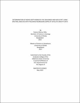
| dc.title | Determination of Moho depth beneath the Okavango and Kafue rift using Spectral Analysis with Piecewise Regression (SAPR) of satellite gravity data | |
| dc.contributor.committeeMember | Laó Dávila, Daniel A. | |
| dc.contributor.committeeMember | Pashin, Jack | |
| osu.filename | Mily_okstate_0664M_18112.pdf | |
| osu.accesstype | Open Access | |
| dc.type.genre | Thesis | |
| dc.type.material | Text | |
| dc.subject.keywords | 2d gravity forward model | |
| dc.subject.keywords | East African Rift System | |
| dc.subject.keywords | Kafue Rift System | |
| dc.subject.keywords | Moho | |
| dc.subject.keywords | Okavango Rift System | |
| dc.subject.keywords | spectral analysis | |
| thesis.degree.discipline | Geology | |
| thesis.degree.grantor | Oklahoma State University | |
