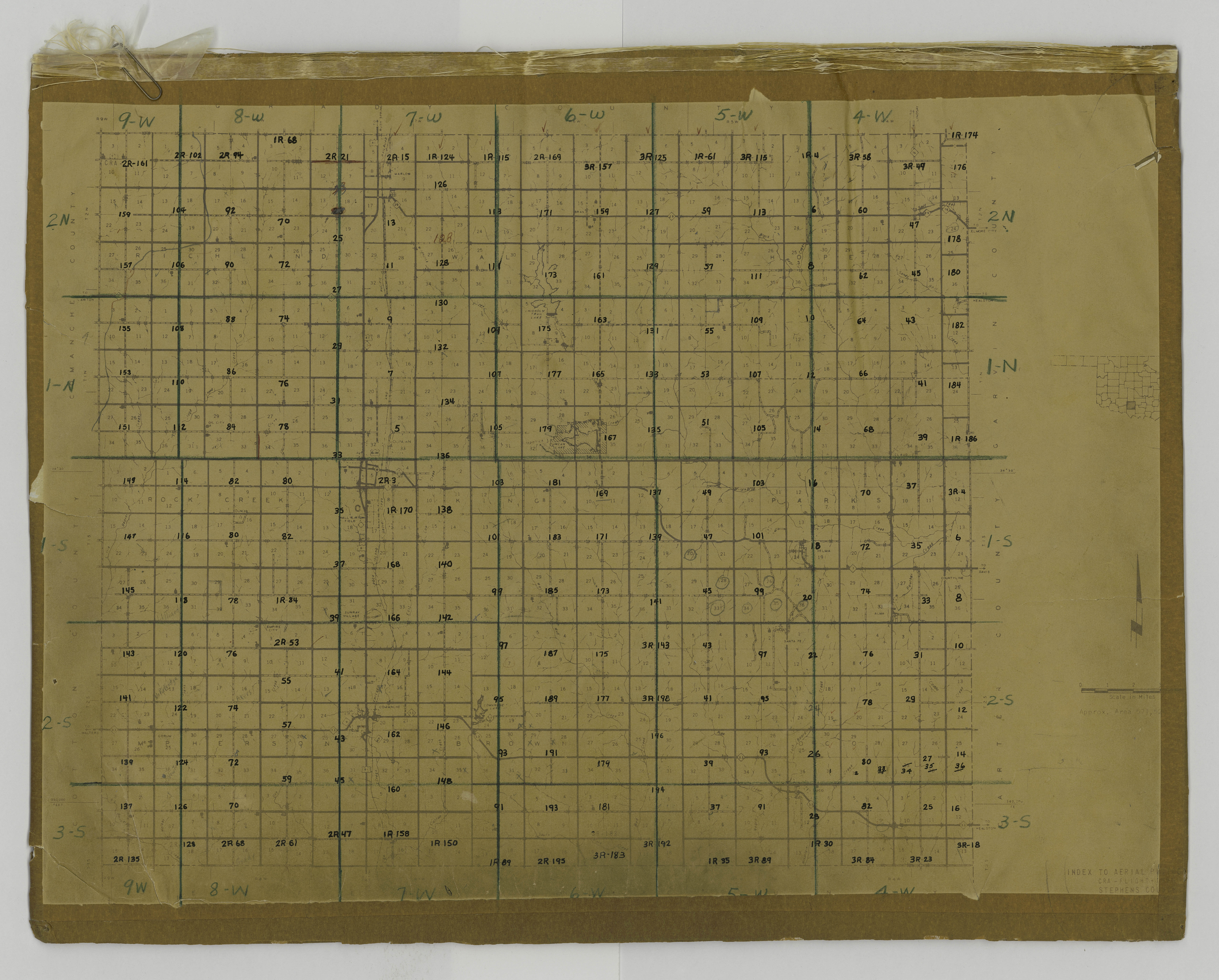
Aerial photo index, Stephens County, OK
| dc.contributor.other | University Libraries Digitization Lab, University of Oklahoma | |
| dc.date.accessioned | 2022-12-02T20:15:11Z | |
| dc.date.available | 2022-12-02T20:15:11Z | |
| dc.identifier.uri | https://hdl.handle.net/11244/336664 | |
| dc.description | Aerial photograph index (map), Stephens County, Oklahoma | |
| dc.format | image/jpeg | |
| dc.format.extent | 22 in x 16.5 in | |
| dc.language | en_US | |
| dc.relation.uri | http://guides.ou.edu/aerial | |
| dc.rights.uri | https://rightsstatements.org/vocab/NKC/1.0/ | |
| dc.title | Aerial photo index, Stephens County, OK | |
| dc.type | stillimage |
Files in this item
This item appears in the following Collection(s)
-
OU - Oklahoma Aerial Photographs [14100]
Oklahoma Aerial Photographs in the OU Library, dating from 1937-1961 (with gaps)