| dc.contributor.advisor | Taghvaeian, Saleh | |
| dc.contributor.author | Khand, Kul Bikram | |
| dc.date.accessioned | 2019-10-25T19:51:51Z | |
| dc.date.available | 2019-10-25T19:51:51Z | |
| dc.date.issued | 2019-05-01 | |
| dc.identifier.uri | https://hdl.handle.net/11244/321595 | |
| dc.description.abstract | Remote sensing has been a promising approach to extracting distributed evapotranspiration (ET) information at varying spatial and temporal scales. Performances of several vegetation index (VI) based and remotely sensed surface energy balance (RSEB) models were evaluated to identify simple and accurate models and apply them to study ET variations from field to regional scales. A simple VI model using a single Landsat image to estimate annual ET was evaluated and successfully captured inter-annual riparian ET variations along a section of the Colorado River, U.S. The study showed the applicability of a simple and accurate approach for annual ET estimation with fewer data and resources. A modeling framework was developed to derive daily time series of ET maps using a RSEB model, satellite imagery, and ground-based weather data. The daily and annual ET maps obtained from the modeling framework successfully captured spatial and temporal ET variations across Oklahoma, U.S. The model also identified the regions that are more susceptible to droughts. Finally, five RSEB models were evaluated for their performance in estimating daily ET of winter wheat under variable grazing and tillage practices in central Oklahoma. The surface energy balance algorithm for land (SEBAL) had the best agreement whit eddy covariance estimates. The daily ET estimates from SEBAL captured the field-scale ET variations within grazing/tillage managements. All studies conducted based on VI and RSEB models over different land covers and spatial/temporal scales identified advantages and limitations of models and developed a framework to construct time series of ET maps, which has a wide range of applications. | |
| dc.format | application/pdf | |
| dc.language | en_US | |
| dc.rights | Copyright is held by the author who has granted the Oklahoma State University Library the non-exclusive right to share this material in its institutional repository. Contact Digital Library Services at lib-dls@okstate.edu or 405-744-9161 for the permission policy on the use, reproduction or distribution of this material. | |
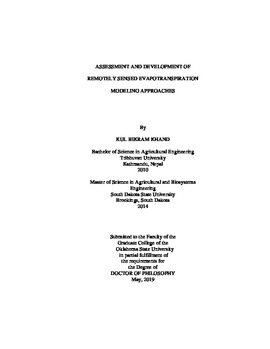
| dc.title | Assessment and Development of Remotely Sensed Evapotranspiration Modeling Approaches | |
| dc.contributor.committeeMember | Weckler, Paul R. | |
| dc.contributor.committeeMember | Gowda, Prasanna H. | |
| dc.contributor.committeeMember | Alderman, Phillip D. | |
| osu.filename | Khand_okstate_0664D_16295.pdf | |
| osu.accesstype | Open Access | |
| dc.type.genre | Dissertation | |
| dc.type.material | Text | |
| dc.subject.keywords | colorado river | |
| dc.subject.keywords | evapotranspiration | |
| dc.subject.keywords | oklahoma | |
| dc.subject.keywords | remote sensing | |
| dc.subject.keywords | surface energy balance | |
| thesis.degree.discipline | Biosystems and Agricultural Engineering | |
| thesis.degree.grantor | Oklahoma State University | |
