Search
Now showing items 20591-20600 of 20656

Aerial photo of Kiowa County, OK, USA, Flight Number CZS-1C-167
(1942-02-02)
Oklahoma aerial photographs in this collection are public domain and were created by U.S. government agencies or contractors to those agencies. The photos are marked with a flight and frame number at the top of the photos, ...
Aerial Photo of Pawnee County, OK, USA, BQK-1-90
(United States Government, 1938-07-12)
Oklahoma aerial photographs in this collection are public domain and were created by U.S. government agencies or contractors to those agencies. The photos are marked with a flight and frame number at the top of the photos, ...
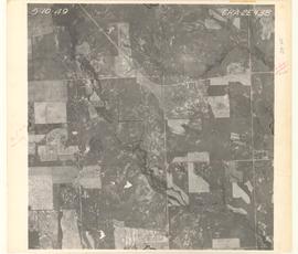
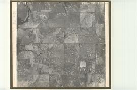
Aerial Photo of Stephens County, OK, USA, CRA-2E-138
(United States Government, 1949-05-10)
Oklahoma aerial photographs in this collection are public domain and were created by U.S. government agencies or contractors to those agencies. The photos are marked with a flight and frame number at the top of the photos, ...
Aerial Photo of McIntosh County, OK, USA, AWJ-3R-162
(United States Government, 1956-07-01)
Oklahoma aerial photographs in this collection are public domain and were created by U.S. government agencies or contractors to those agencies. The photos are marked with a flight and frame number at the top of the photos, ...
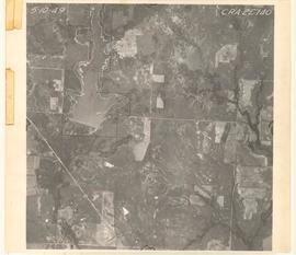
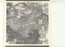
Aerial Photo of Stephens County, OK, USA, CRA-2E-140
(United States Government, 1949-05-10)
Oklahoma aerial photographs in this collection are public domain and were created by U.S. government agencies or contractors to those agencies. The photos are marked with a flight and frame number at the top of the photos, ...
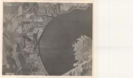
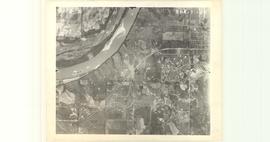
Aerial Photo of Mayes County, OK, USA, CMO-6-30
(United States Government, 1940-06-29)
Oklahoma aerial photographs in this collection are public domain and were created by U.S. government agencies or contractors to those agencies. The photos are marked with a flight and frame number at the top of the photos, ...
Aerial Photo of Stephens County, OK, USA, CRA-2R-143
(United States Government, 1956-06-21)
Oklahoma aerial photographs in this collection are public domain and were created by U.S. government agencies or contractors to those agencies. The photos are marked with a flight and frame number at the top of the photos, ...

Aerial Photo of Carter County, OK, USA, AE-103-62
(United States Government, 1937-03-20)
Oklahoma aerial photographs in this collection are public domain and were created by U.S. government agencies or contractors to those agencies. The photos are marked with a flight and frame number at the top of the photos, ...
Hedging in the interest rate markets.
(1997)
The suitability of GARCH and EGARCH models in a cross-hedging framework is also examined whereby a T-bill spot position is hedged with Eurodollar futures. The naive and risk-minimization models are also included in this ...